A government spokesperson denied the existence of a facility. Three days later a journalist in London opens up a browser and enters the coordinates for the location and is shown a photograph taken the previous day.
The ability to provide daily imagery of anywhere on Earth without a source, press pass or tip-off did not come from intelligence agencies. It came from arable farming.
Why Your Wheat Field Needed Eyes in Orbit
For precision agriculture, farmers need to know the revisit rate of satellites, i.e. how often a satellite passes over the same area of land. A farmer in Lincolnshire may have part of his field under water stress and he would need a photo of the area from yesterday, not three weeks ago. Ideally this morning.
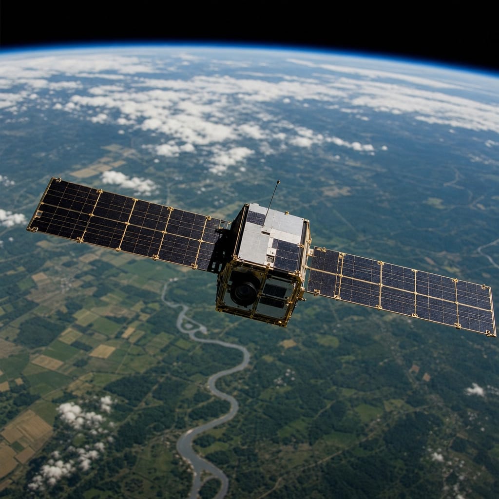
The demand for high frequency, broad coverage and commercially priced imagery broke the old satellite model. The Cold War era spy satellites were huge, expensive and dedicated to specific government targets. They could not be rented for any price. Commercial farming needed something different. The new generation of small and inexpensive satellites, launched dozens at once and spread out in different orbits, can together provide imagery of any point on Earth every 24 hours or less.
The Carbon Credit That Paid for the Whole Thing
Of course, farmers weren’t the only ones under pressure. Green finance – buying and selling carbon credits tied to intact forests – as well as climate insurance needed proof of existence of a forest on a regular basis, i.e. on a quarterly basis. Low Earth orbit was soon crowded with hundreds of imaging satellites. All of them were offered for hire at prices a newspaper could actually afford.
Revisit rate started out as a farming tool. Then it became the most stubborn form of evidence gathering for journalism – no access, no contacts, no co-operation necessary. Newsbug's Damp Has Three Dialects, and They Are Not Saying the Same Thing works the same principle on a domestic scale, reading physical evidence already there rather than waiting for someone else to explain it.
The Same Platform, Two Completely Different Questions
The farmer uses it to check whether his cattle are in the field the farmhand claims to have seen them in. The journalist uses it to check whether there are military vehicles at the border where his government has just told him there are none. Same satellite, same image – completely different story.
What changed journalism was not the technology exactly, but the economics behind it. Farmers’ demand for ag-specific imagery, and carbon accounting, brought launch costs down to the point where a reporter’s modest budget could secretly pay to look through a satellite’s images. No intelligence budget required.
—
How accurate is the imagery – can it really tell one vehicle type from another?
Yes, though it depends on the satellite's sensor. Modern commercial platforms offer resolutions fine enough to distinguish vehicle types and count individual units. The really useful technique is change detection: comparing one day's image to the previous one and flagging what moved, appeared, or vanished overnight.
Can journalists access old images, or only current ones?
Most commercial platforms keep an archive going back several years so a newsroom can pull a historical sequence of content and recreate a timeline around an event or story such as the building of a facility, the demolition of a village or the illegal logging of trees. These stories are told with a sequence of images rather than a single image, which provides context to show what happened before and what happened afterwards.
Do governments try to time activity between satellite passes?
Yes, some people move their equipment inside their properties, cover their vehicles with nets, and even schedule their visible activities away from the time of the overpass of the passing satellites. However, the orbits of dozens of satellites are slightly different and therefore the time of overpass is irregular and becoming increasingly unpredictable. Also, any unusual attempt to hide a normally mundane site is counterproductive and tends to attract attention rather than deflect it.
Do you need to be a large news organisation to get access?
No. While commercial providers offer a range of subscription options, several academic and open-source archives of historical imagery are free to download. A small investigative publisher, an academic researcher and the BBC are all drawing from the same provider pool. While 15 years ago this would not have been true, the same market forces that created the constellation in the first place have continued to drive down the price.
Is this only useful for military and political stories?
No. Environmental journalists can track illegal fishing, mining encroachments on protected land and the rate of retreat of glaciers over decades. Humanitarian organisations can track displacement by monitoring settlements over time. Insurance companies can check the facts of claims. Estate agents in some markets can use historical imagery to confirm whether outbuildings at a property are as old as the vendor claims. The core functionality is simple: you can see what was there, and when.